Expanding India’s geospatial technology
- Posted By
10Pointer
- Categories
Science & Technology
- Published
3rd Oct, 2022
-
-
Context
Recently, in a briefing to announce the second United Nations World Geospatial Information Congress (UNWGIC), the Union Science Minister said that India’s geospatial technology industry was expected to cross ?63,100 crore by 2025 at a growth rate of 12.8%.

|
United Nations World Geospatial Information Congress (UNWGIC)
- It is scheduled from October 10 to 14 in Hyderabad, India.
- The conference is expected to be attended by over 2,000 delegates and participants from about 120 countries.
- It will also have participants from the Survey of India, a 255-year-old organisation, and senior officials, non-governmental organisations and academia.
|
Background
- In 2021, India has announced plans to prepare digital maps of all its 6, 00,000 villages, and pan-India 3D maps will be prepared for 100 cities.
- The Ministry of Science and Technology has released new guidelines for the Geo-Spatial Sector in India, which deregulates existing protocol and liberalises the sector to a more competitive field.
-
About
What is Geo-spatial Technology?
- In simple terms, geospatial refers to location-specific Geospatial information relates to features on the surface of the earth and their geographic locations.
- Geospatial data is any data that has a geographic component to it. It can describe features, objects, or even events that have a specific location.
- Geospatial data will combine information about the location and attributes of an object.
- Location information can be either ‘dynamic’ or ‘static’.
-
Analysis
How the data is collected using Geo-spatial Technology?
- The data can be collected in a variety of ways such as using remote sensing and geospatial data can be collected without close proximity to the area.
- For example, vast amounts of information can be gathered using unmanned aerial vehicles which make gathering this information fast and effective.
|
The data can be collected via following mechanism:
- Vectors: Vectors consist of points, lines and polygons. Each point has a coordinate, and lines and polygons are formed by connecting these. These elements represent real-world features in any given environment. Each feature will have text or numerical attributes to describe them.
- Satellite imagery: High-resolution satellite imagery is a type of geospatial data too. Satellites can help to view our world from a distance, showing us a much bigger picture.
- Census data: When census data is linked to a geographic area, it becomes a type of geospatial data too. For example, city planners will use population data from a Census to plan where they might build new roads, schools or hospitals.
|
-
India’s Geo-spatial Industry
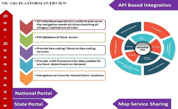
- India’s geospatial sector is managed by the Survey of India (SoI), the Indian Space Research Organisation (ISRO), Remote Sensing Application Centres (RSACs), and the National Informatics Centre (NIC) in particular, and all ministries and departments.
- In 2021, the geospatial market was dominated by defence and intelligence (14.05 %), urban development (12.93 %) and utilities (11 %) segments, cumulatively accounting for 37.98% of the total geospatial market.
- However, it is now expanding in all the areas exploring its uses.
-
How it will be helpful?
- A Potential Sector: The sector has potential to grow to Rs. 63,100 crore at 12.8% by the end of 2025 as per India Geospatial Artha Report
- Applicability in important areas: A major segment of its utility is applied in areas like agriculture, telecommunications, disaster and climate management, environmental studies, architecture, etc.
- Employment: Private Companies like Amazon, Zomato etc. use this technology to smoothly conduct their delivery operations which supports livelihood generation.
- Implementation of Schemes: The schemes like the Gati Shakti program can be smoothly implemented using geospatial technology.
- Make in India: Focusing on the sector allows Indian companies to develop indigenous apps like an Indian version of Google maps.
- Management of Land records: Using the technology, the data related to a large number of landholdings can be appropriately tagged and digitised.
- It will not only help better targeting but also reduce the quantum of land disputes in courts.
Challenges associated:
- Lack of skilled manpower for using the technology and data sourced out of it.
- Unavailability of Foundation or previous data to compare with the new data obtained.
- Lack of collaborative approach among ministries and departments regarding geo-spatial data.
Recent Government Initiatives
|
SVAMITVA (Survey of Villages and Mapping with Improvised Technology in Village Areas): It is an on-going scheme, piloted by the Ministry of Panchayati Raj, launched by Prime Minister Narendra Modi in April 2020 to digitise land records.
|
- Large amounts of spatial data are already being utilised in key infrastructure programmes like the National Hydrology Project (NHP), Bharatmala, AMRUT, Smart Cities, SVAMITVA and National Infrastructure Pipeline (NIP).