How are cyclones forecast?
- Posted By
10Pointer
- Categories
Science & Technology
- Published
1st Dec, 2020
-
Context
- The Nivar storm originated in the Bay of Bengal and whipped up windspeeds close to 125-145 kmph, blowing away roofs and felling standing crop.
How are cyclones forecast?
- There is a network of 12 doppler weather radar(DWR) along India’s coast if one were to begin counting from Kolkata and trawl up to Mumbai — there are 27 in all in the country.
- Depending on where a storm is forming, these radars send pulses of radio waves to gauge the size as well as the speed at which water droplets are moving.
- With DWRs, now the base standard of weather radars, it is usually possible to detect a potential storm at least four-five days in advance.
- The IMD also collaborates with similar international networks, such as the Japan Meteorological Agency, the U.S. National Hurricane Center, and the U.S. Central Pacific Hurricane Center, and these bodies constantly send warnings and forecasts about changes in the ocean weather.
- The near ubiquity of ocean-buoys that track changes in ocean sea surface temperatures as well as dedicated meteorological satellites improve the odds of early detection.
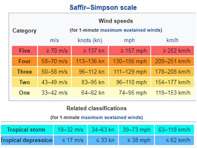
Five-stage classification for cyclones
- The IMD follows a five-stage classification for cyclones, with the lowest a ‘cyclonic storm’ generating wind speeds of 62-87 kmph, and the highest a ‘super cyclonic storm’, generating winds over 222 kmph.
How has disaster warning changed?
- The formation of cyclones is preceded by ‘depressions’, and they are often the first warnings.
- Not all depressions become cyclones, but many coastal States — especially those with a history of being battered — begin organising shelters and evacuation of coastal residents.
- While meteorological agencies give advisories on where fish-catches are likely, they suspend such advisories during storm formation to dissuade fishermen from venturing out.
- The ubiquity of mobile communication makes it much easier to quickly give warnings.
- The IMD also issues flood forecast maps, in collaboration with urban bodies that forecast which pockets in a city are likely to be flooded and where crop damage is likely to be maximum.