Current Affairs
Explained

Lineament factor for Assam earthquake

  • Posted By
    10Pointer
  • Categories
    Geography
  • Published
    7th May, 2021
  • Context

    An unfamiliar lineament is among four factors behind frequent earthquakes in northern Assam’s Sonitpur area.

  • Background

    • The past century saw several great earthquakes:
      • the 1905 Kangra earthquake
      • the 1934 Bihar-Nepal earthquake
      • the 1950 Assam earthquake
    • In case of the Assam earthquake of 1950, we found that the reason for widespread devastation in the eastern Himalayan belt was due to dual ruptures on the Himalayan Frontal Thrust near Pasighat and on the Mishmi Thrust.
    • However, preliminary data on this latest quake in Assam indicated that the quake occurred along the Kopili fault itself.
    • According to the Geological Survey of India (GSI), Sonitpur district lies within a tectonically complex triangular area bounded by the east-west trending Atherkhet Fault, the northwest-southeast trending Kopili Fault and a north-south trending lineament.
    • The two faults and the lineament, along with the oblique convergence of the Indian plate, have caused frequent earthquakes.
    • The National Centre of Seismology recorded 29 earthquakes of magnitude varying from 2.6 to 4.7 in Sonitpur after the 6.4 tremblor on April 28 that damaged several buildings, bridges and a river embankment.
  • Analysis

    What is a lineament?

    • A lineament is a linear feature in a landscape dictated by an underlying geological structure such as a fault.
    • These have been variously named as 'fracture zones,' 'shear zones,' 'trend lines' and' tectonic trends'.
    • Location: Typically a lineament will appear as a fault-aligned valley, a series of fault or fold-aligned hills, a straight coastline or indeed a combination of these features.

    National Centre for Seismology

    • It is an office of India's Ministry of Earth Sciences.
    • The office monitors earthquakes and conducts seismological research.
    • It provides earthquake surveillance and hazard reports to governmental agencies.
    • It consists of various divisions:
      • Earthquake Monitoring & Services
      • Earthquake Hazard & Risk Assessments
      • Geophysical Observation Systems
  • India’s major lineaments

    • Location: In India, lineaments or tectonic trends have been reported from some parts of the country which are based on stratigraphic, structural and geophysical data.
    • Mapping: National Geomorphological and Lineamentmapping has been one of the major efforts to find out the major lineaments in India.
    • It was done using remote sensing data, for mapping the diversity of landform in the country and was jointly executed by ISRO and GSI/Ministry of Mines, along with more than 15 partner institutions across the country.
  • Major geological features behind the earthquake of Sonitpur

    • The preliminary analysis shows that the earthquake events are located near to Kopili Fault which is closer to Himalayan Frontal Thrust (HFT).
    • The area is seismically very active falling in the highest Seismic Hazard zone V and are associated with collisional tectonics where Indian plate sub-ducts beneath the Eurasian Plate.
    • HFT is also known as the Main Frontal Thrust (MFT).
      • It is a geological fault along the boundary of the Indian and Eurasian tectonic plates.
    • Triangular area: According to the Geological Survey of India (GSI), Sonitpur district lies within a tectonically complex triangular area.
      • Faults: It is bounded by
        • The east-west trending Atherkhet Fault
        • The northwest-southeast trending Kopili Fault: The Kopili Fault is a 300-km northwest-southeast trending fault from the Bhutan Himalaya to the Burmese arc.
        • north-south trending lineament
      • Major reason: The two faults and the lineament, along with the oblique convergence of the Indian plate, have caused frequent earthquakes.
        • Both the Atherkhet and Kopili faults are said to be major reasons because of the tectonic complexity.
        • Atherkhet and Kopilli are active lineament which are involved in earthquake.
        • Atherkhet and Kopili are not the only faults that impact the Sonitpur region.

    History of quakes in Assam

    • The region has seen several “moderate to large earthquakes”.
    • The worst of these was the great Assam-Tibet Earthquake that occurred on Independence Day in 1950.
    • Another great earthquake, of magnitude 8.1, had shaken Assam earlier on June 12, 1897.
      • The shaking due to this earthquake was felt at several places across the Indian subcontinent. Large fissures of 18 to 30 m ran parallel to the banks of the Brahmaputra River and its various tributaries.
  • Main faults behind the North-East tremor

    • Highly vulnerable: The northeast is demarcated as Seismic Zone V, which indicates a zone with high vulnerability.
    • Movement of plate: The Indian plate is moving northeast toward the Eurasian plate in the Himalayan region, their oblique collision and release of stress and strain accumulated in the local tectonic or fault environments lead to earthquakes.
    • The Siang Fracture
    • Yemla Fault
    • Namula Thrust
    • Canyon Thrust
    • Main Himalayan Thrust
    • Main Boundary Thrust

    Main Central Thrust

    • Seismic zone 
    • Seismic belt is an area of seismicity potentially sharing a common cause.
    • Based on the past seismic history, Bureau of Indian Standards grouped the country into four seismic zones namely Zone-II, Zone-III, Zone-IV and Zone-V. Of all these four zones, Zone-V is the most seismic active region whereas Zone-II is the least.
    • Seismic Zone

    Intensity on M.M Scale

    • Zone-II (Low-Intensity Zone)

    6 (or less)

    • Zone-III (Moderate Intensity Zone)

    7

    • Zone-IV (Severe Intensity Zone)

    8

    • Zone-V (Very Severe Intensity Zone)

    9 (and above)

    • Indian Regions under the Seismic zones
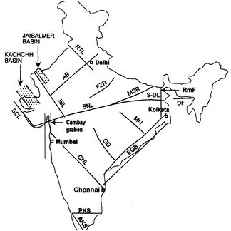
    • Zone-V covers entire northeastern India, some parts of Jammu and Kashmir, some parts of Ladakh, Himachal Pradesh, Uttarakhand, Rann of Kutch in Gujarat, some parts of North Bihar and Andaman & Nicobar Islands.
    • Zone-IV covers remaining parts of Jammu & Kashmir, Ladakh and Himachal Pradesh, Union Territory of Delhi, Sikkim, northern parts of Uttar Pradesh, Bihar and West Bengal, parts of Gujarat and small portions of Maharashtra near the west coast and Rajasthan.
    • Zone-III comprises of Kerala, Goa, Lakshadweep islands, remaining parts of Uttar Pradesh, Gujarat and West Bengal, parts of Punjab, Rajasthan, Madhya Pradesh, Bihar, Jharkhand, Chhattisgarh, Maharashtra, Odisha, Andhra Pradesh, Tamil Nadu and Karnataka.
    • Zone-II covers remaining parts of the country.
  • Conclusion

    Assam earthquake has brought the focus back on smaller faultlines like Kopili, as scientists stress on the need for more studies and data on the region’s lesser known seismicity. Furthermore, there is a lot of scope to improve data collection and dissemination for seismic events in order to handle the situation in a better way.

Verifying, please be patient.